Wednesday, February 29, 2012
Thursday, February 23, 2012

Students from a previous class walking along the old Union Branch railroad easement.
The picture was taken in 2009, before excavation began to convert the tracks
into a cycling and walking path.

Excavation for the Bayside Trail project.

This is the same trail several months later in May of 2009. This part of the trail is likely to be flooded by tidal waters by the end of the 21st century barring preventative measures.

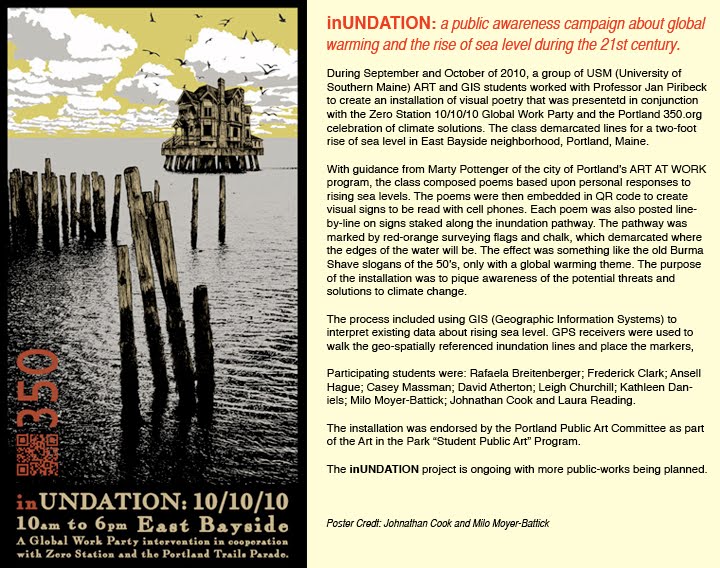
A GIS map of East Bayside Neighborhood showing the effects of a 2' rise in
sea level. The red lines demarcate the area that will be inundated with water.

Cove waters seeping onto the sidewalk and street along Marginal Way near "Cove" Street.

At the highest of high tides, the street is flooded to a degree that it is barely passable for some vehicles. This picture was taken in September of 2010 during new moon.

Circa: early 1900's. This picture was discovered by a
digital art student in the archives of the Portland Historical Society.

The picture was taken of the same location in September of 2010.
The cove is reclaiming its edge along Marginal Way.

The data for the inundation lines was loaded into an iPaq receiver; the unit allows users to locate themselves spatially. Students used the iPaq to find and walk the inundation lines along the Bayside Trail and Marginal Way.

Fred Clark in blue and David Atherton in orange. David used the receiver to find the inundation line, and Fred marked the pavement with orange chalk. A circle template was used to make a temporary dotted line.


Project Tools: surveying flags and orange, highly pigmented sidewalk chalk

The flags were used to make a line demarcating where the edge of the water will be.

Art student Leigh Churchill placing a flag in an empty lot near Cove Street; the lot is owned by Cardente Real Estate, who gave permission to post flags there. Other businesses in the area also gave permission to post flags and/or chalk mark pavement on their properties.

Poetry Workshop: Marty Pottenger, Director of the city of Portland's Art at Work program conducted a workshop with the class at Zero Station, an exhibition space in East Bayside neighborhood. Students were encouraged to connect with their feelings about sea level rising. Drawing on the experience of the workshop, students composed poems using the same structure as the old Burma Shave slogans of the 1950's. Burma Shave slogans were posted along the roadway to be read as one drove by; they made for engaging advertising.

Here is an example of one of the poems; it is embedded in the QR Code in the cell phone graphic. QR stands for quick response; it is a code that can be quickly read by a cell phone or other portable devices. Code readers can easily be found on the Internet.

This is how the poems looked along the trail. They were printed one line to a sign,
laminated and attached to white stakes driven about every 10 feet.


The entire poem is embedded in this code. The graphic is a
visual queue to prompt people to use their cell phones.

This is part of the installation on Marginal Way during high tide;
the view is from "Cove" Street.

QR Codes are often used in advertising. Times Square, New York

Kota Kinabalu, Malaysia October 10, 2010. People made a 350 sign out of trash on the beach; this was one of over 7,000 climate action events taking place in 188 countries
on 10/10/10 as part of the Global Work Party. Photo Credit: 350.org/Cynthia Ong

The Zero Station 10/10/10 Global Work Party raising the 350 banner at the East End Beach.
The banner was created by an interfaith group in Portland.

The 350 banner draped outside of Zero Station

10/10/10 Parade Participant

10/10/10/ Parade Participant
Subscribe to:
Posts (Atom)